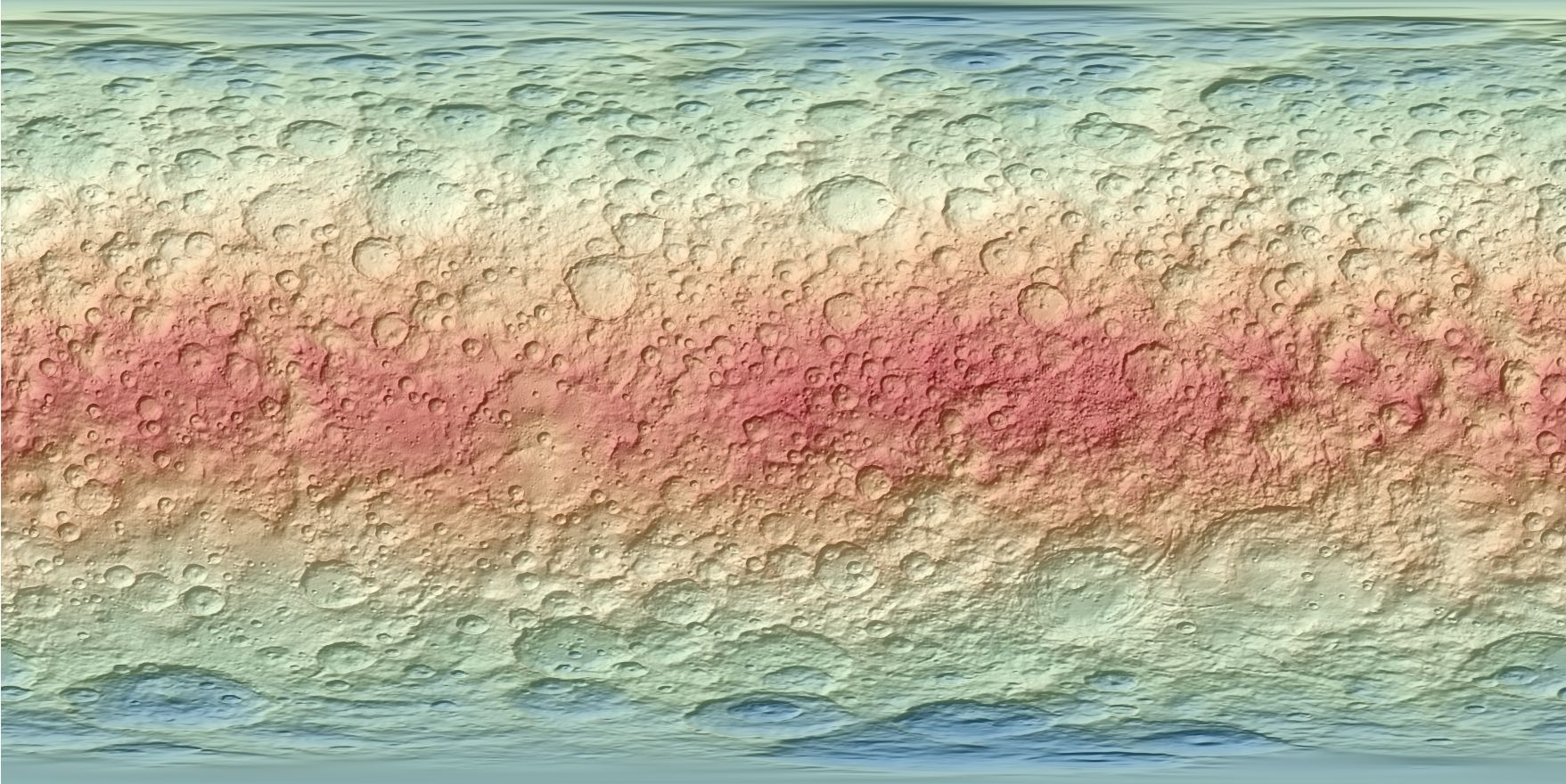
Ceres Dawn FC2 HAMO Global DTM 137m v1
[Descripción] This digital terrain model (DTM) of Ceres based on the Dawn High Altitude Mapping Orbit (HAMO) Framing Camera 2 (FC2) images and derived by using the stereo photogrammetry (SPG) method. The HAMO DTM covers approximately 98% of Ceres surface (few permanently shadowed areas near the poles required interpolation).
[Autoría] German Aerospace Center (DLR).
[Web original] https://astrogeology.usgs.gov/search/map/Ceres/Dawn/DLR/FramingCamera/Ceres_Dawn_FC_HAMO_DTM_DLR_Global_60ppd_Oct2016
[Formato] Ráster: geotiff.
[Resolución espacial / Escala] 136.7 m.
[SRS] Equirectangular Projection.
[Licencia] Access constraints: none. Use constraints: please cite authors.
[Descarga en origen] https://planetarymaps.usgs.gov/mosaic/Ceres_Dawn_FC_HAMO_DTM_DLR_Global_60ppd_Oct2016.tif
[Descarga en local] N/A
[Observaciones]
[Extensión geográfica] Minimum Latitude-90º; Maximum Latitude: 90º; Minimum Longitude: 0º; Maximum Longitude: 360º.