Mapa geológico de Venezuela 1:750k
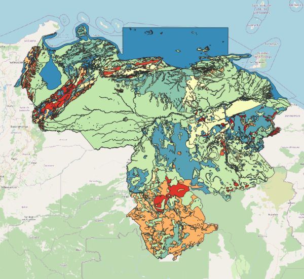
[Descripción] The digital geologic map and GIS database of Venezuela captures GIS compatible geologic and hydrologic data from the "Geologic Shaded Relief Map of Venezuela," which was released online as U.S. Geological Survey Open-File Report 2005-1038. Feature classes in the geodatabase include geologic unit polygons, open water polygons, coincident geologic unit linework (contacts, faults, etc.) and non-coincident geologic unit linework (folds, drainage networks, etc.). Geologic unit polygon data were attributed for age, name, and lithologic type following the Léxico Estratigráfico de Venezuela. All digital datasets were captured from source data at 1:750,000. Although users may view and analyze data at varying scales, the authors make no guarantee as to the accuracy of the data at scales larger than 1:750,000.
[Autoría] Christopher P. Garrity (USGS), Paul C. Hackley (USGS), Franco Urbani (Escuela Geología, Minas y Geofísica, Universidad Central de Venezuela).
[Web original] USGS, http://pubs.usgs.gov/ds/2006/199
[Formato] Vectorial; original: mdb; local: geopackage.
[Resolución espacial / Escala] 1:750.000
[SRS] EPSG:4326
[Licencia] No se especifica, la descarga es directa y sin registro previo.
[Descarga en origen] https://pubs.usgs.gov/ds/2006/199/USGS_06_DS_199.zip
[Descarga en local] v862_geol_750k
[Observaciones]
[Extensión geográfica]