Open Topography - High-Resolution Topography Data and Tools
[Descripción] Pagina principal en https://opentopography.org/ Descripción en https://opentopography.org/about
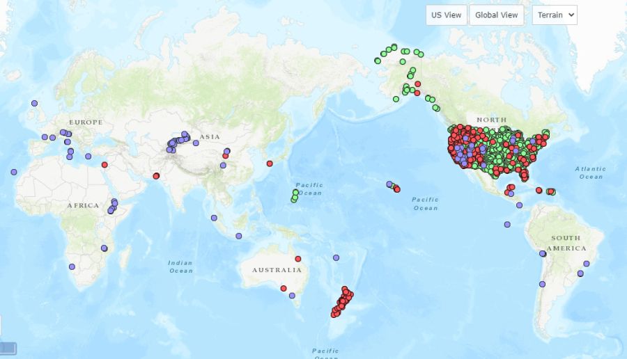
[Contenidos] Datos muy variados, con mayoría de nubes de puntos LiDAR de extensiones pequeñas a moderadas (bajo la palara clave LiDAR se listan 761 conjuntos de datos).
[Resolución espacial / Escala] Variable.
[SRS] EPSG variables, normalmente locales.
[Licencia] Data license, citation, and acknowledgment infromation may be found on a dataset's access page and through a dataset's metadata. Most of the data held by OpenTopography are government-funded and in the public domain. Data obtained from OpenTopography are free of all copyright restrictions and made fully and freely available for both non-commercial and commercial uses. Certain datasets may have open data licenses (e.g., Creative Common CC BY 4.0) associated with them.
[Descarga en origen] https://portal.opentopography.org/datasets
[Descarga en local] N/A
[Observaciones] Ver https://opentopography.org/citations
[Extensión geográfica] Global, con mucha más abundancia de datos en los EE.UU.