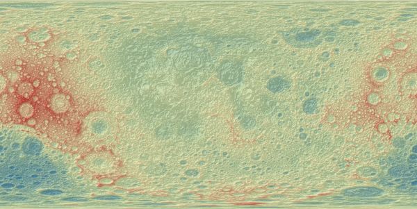
Moon LRO LOLA DEM 118m v1
[Descripción] This Moon DEM is based on data from the Lunar Orbiter Laser Altimeter (LOLA), an instrument on the National Aeronautics and Space Agency (NASA) Lunar Reconnaissance Orbiter (LRO) spacecraft. The created DEM represents more than 6.5 billion measurements gathered between July 2009 and July 2013, adjusted for consistency in the coordinate system, and then converted to lunar radii.
[Autoría] LOLA Science Team, Goddard Space Flight Center, NASA.
[Web original] https://astrogeology.usgs.gov/search/details/Moon/LRO/LOLA/Lunar_LRO_LOLA_Global_LDEM_118m_Mar2014/cub
[Formato] Ráster: geotiff.
[Resolución espacial / Escala] 256 m
[SRS] Simple cylindrical projection.
[Licencia] Public domain, please cite authors.
[Descarga en origen] https://planetarymaps.usgs.gov/mosaic/Lunar_LRO_LOLA_Global_LDEM_118m_Mar2014.tif (7.9 GB)
[Descarga en local] N/A
[Observaciones] Más información en https://pds-geosciences.wustl.edu/missions/lro/lola.htm
[Extensión geográfica] Min. Latitude: -90º; Max. Latitude: 90º; Min. Longitude: -180º; Max. Longitude: 180º.
Imagen con sombreado analítico sobre la escala hipsométrica.