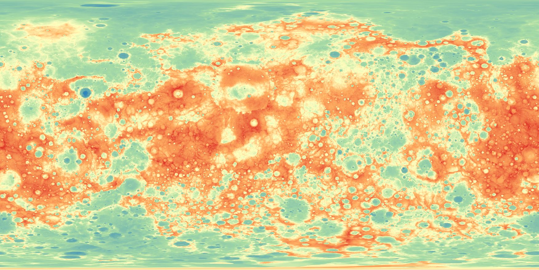
Mercury MESSENGER Global DEM 665m v2
[Descripción] The MErcury Surface, Space Environment, Geochemistry, and Ranging (MESSENGER) spacecraft launched on August 3rd, 2004, it entered orbit around Mercury on March 11, 2011 and ended its mission on April 30th, 2015. Using the Integrated Software for Imagers and Spectrometers (ISIS3) and observations from Mercury Dual Imaging System (MDIS) narrow-angle camera (NAC) and multispectral wide-angle camera (WAC), we derived a global digital elevation model (DEM) of Mercury.
[Autoría] Kris Becker, NASA , Arizona State University , Johns Hopkins Applied Physics Laboratory, Carnegie Institution for Science.
[Web original] https://astrogeology.usgs.gov/search/map/Mercury/Topography/MESSENGER/Mercury_Messenger_USGS_DEM_Global_665m_v2
[Formato] ráster, original: tif; local: geotiff.
[Resolución espacial / Escala] 665 m
[SRS] Original: no tiene; local: EPSG 4326 (aunque este SRS es terrestre, la gestión con QGIS es correcta simulándolo).
[Licencia] https://astrogeology.usgs.gov/cache/images/ea29280c770e2f13b3ff0cbaaabf2920_Mercury_Messenger_DEM_Global_665m_1024.jpg
[Descarga en origen] Desde https://astrogeology.usgs.gov/search/map/Mercury/Topography/MESSENGER/Mercury_Messenger_USGS_DEM_Global_665m_v2 (tif 506 MB)
[Descarga en local] Mercurio_MDE_665m (229 MB).
[Observaciones] Becker, K. J., Robinson, M. S., Becker, T. L., Weller, L. A., Edmundson, K. L., Neumann, G. A., Perry, M. E., et al. (2016). First global digital elevation model of Mercury. Paper presented at the 47th Lunar and Planetary Science Conference, Lunar and Planetary Institute, Houston, TX. https://www.hou.usra.edu/meetings/lpsc2016/pdf/2959.pdf
[Extensión geográfica] Escala de color QGIS Spectral.