GeoDa
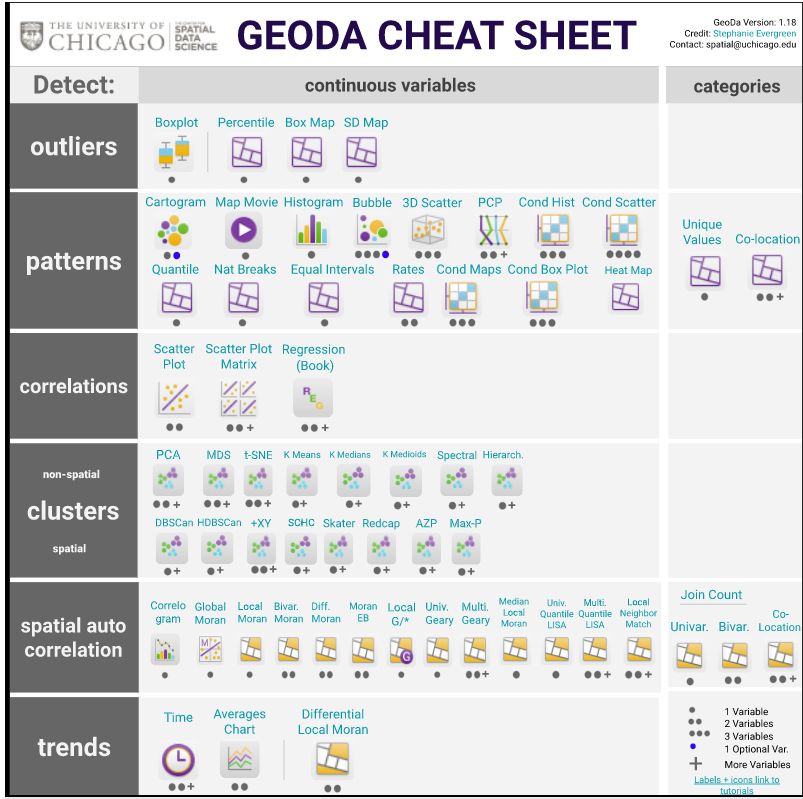
[Descripción] GeoDa is a free and open source software tool that serves as an introduction to spatial data science. It is designed to facilitate new insights from data analysis by exploring and modeling spatial patterns.
[Web] https://geodacenter.github.io/
[Documentación] https://geodacenter.github.io/documentation.html
[Licencia] GPL.
[Sistema operativo] GNU/Linux (Ubuntu), Mac OS/X y Microsoft Windows.
[Observaciones] The latest version 1.20 contains multi-layer support, several new local cluster features, including univariate and multivariate local Geary cluster maps, redcap, skater, spectral clustering and max-p, and local join count maps for categorical data. It also implements several classic non-spatial cluster techniques (principal component analysis, k-means, and hierarchical clustering).
Imagen tomada de la web oficial.