CHIRPS - Rainfall estimates
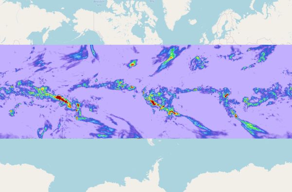
[Descripción] Climate Hazards Group InfraRed Precipitation with Station data (CHIRPS) is a 35+ year quasi-global rainfall data set. Spanning 50°S-50°N (and all longitudes) and ranging from 1981 to near-present, CHIRPS incorporates our in-house climatology, CHPclim, 0.05° resolution satellite imagery, and in-situ station data to create gridded rainfall time series for trend analysis and seasonal drought monitoring.
[Autoría] Climate Hazards Group InfraRed Precipitation with Station data.
[Web original] https://www.chc.ucsb.edu/data/chirps
[Formato] Vectorial Ráster Tabla
[Resolución espacial / Escala]
[SRS] EPSG:
[Licencia] CHIRPS data is in the public domain as registered with Creative Commons.
[Descarga en origen] Acceso a varios conjuntos de datos en https://www.chc.ucsb.edu/data
[Descarga en local] N/A
[Observaciones] Read more about CHIRPS here: https://www.nature.com/articles/sdata201566
[Extensión geográfica] de 50º N a 50º S.