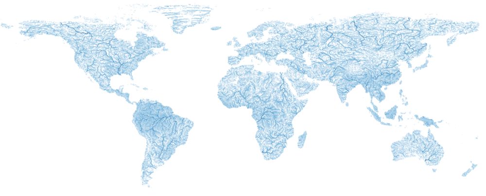
HydroSHEEDS
[Descripción] HydroSHEDS is a mapping product that provides hydrographic information for regional and global-scale applications in a consistent format. It offers a suite of geo-referenced data sets (vector & raster) at various scales, including river networks, watershed boundaries, drainage directions, and flow accumulations. HydroSHEDS is based on high-resolution elevation data obtained during a Space Shuttle flight for NASA's Shuttle Radar Topography Mission (SRTM). Products are:
- Void-filled elevation (DEM), raster, spatial resolution: 3 sec, 15 sec, 30 sec.
- Hydrologically conditioned elevation (CON), raster, 3 sec.
- Drainage directions (DIR), raster, 3 sec, 15 sec, 30 sec.
- Flow accumulation (ACC), raster, 15 sec, 30 sec.
- River network (RIV), vector, 15 sec, 30 sec.
- Drainage basins (BAS), vector, 15 sec, 30 sec.
- HydroBASINS, vector, 15 sec.
- GloRiC: hydrologic, physio-climatic, and geomorphic sub-classification, as well as a combined type for every river reach, resulting in a total of 127 river reach types.
- HydroATLAS: comprehensive database gathering and presenting a wide range of hydro-environmental attributes from existing global datasets in a consistent and organized manner.
[Autoría] Conservation Science Program of World Wildlife Fund (WWF).
[Web original] https://www.hydrosheds.org/
[Formato] Vectorial: geodatabase, shapefile; Ráster: grid, bil,
[Resolución espacial / Escala]
[SRS] EPSG:4326
[Licencia] HydroSHEDS data are free for non-commercial and commercial use (ver licencia y forma de citar los productos en https://www.hydrosheds.org/page/license).
[Descarga en origen] Cada producto se descarga en lugares diferentes
- HydroSHEDS, https://www.hydrosheds.org/downloads
- HydroRIVERS, https://www.hydrosheds.org/page/hydrorivers
- HydroLAKES, https://www.hydrosheds.org/page/hydrolakes
- HidroATLAS, https://figshare.com/articles/dataset/HydroATLAS_version_1_0/9890531
- GloRiC, https://www.hydrosheds.org/page/gloric
[Descarga en local] N/A
[Observaciones] Descarga directa y sin registro previo.
[Extensión geográfica] Global salvo Antártida.