Global Wind Atlas
[Descripción] the Global Wind Atlas is a free, web-based application developed to help policymakers, planners, and investors identify high-wind areas for wind power generation virtually anywhere in the world, and then perform preliminary calculations. The Global Wind Atlas facilitates online queries and provides freely downloadable datasets based on the latest input data and modeling methodologies. Users can additionally download high-resolution maps of the wind resource potential, for use in GIS tools, at the global, country, and first-administrative unit (State, Province...). Ver https://globalwindatlas.info/about/introduction
Entre las capas disponibles:
- Capacity Factor IEC, clases I, II y III.
- mean wind speed.
- mean power density.
- roughness length (terrain).
- ruggedness index.
[Autoría] https://globalwindatlas.info/about/credits
[Web original] Global Wind Atlas https://globalwindatlas.info/
[Formato] Ráster: geotiff.
[Resolución espacial / Escala] 250 m.
[SRS] EPSG:4326.
[Licencia] The Works are licensed under the Creative Commons Attribution 4.0 International license, CC BY 4.0, except where expressly stated that another license applies.
[Descarga en origen]
Vía 1: desde el visor de mapas, una vez definida la zona de interés, se despliega del "Datapanel" y se descarga con el botón Download en la esquina superior derecha;
Vía 2: por países desde https://globalwindatlas.info/download/gis-files
[Descarga en local] N/A.
[Observaciones] Se especifica como texto de cita: [Data/information/map obtained from the] “Global Wind Atlas 3.0, a free, web-based application developed, owned and operated by the Technical University of Denmark (DTU). The Global Wind Atlas 3.0 is released in partnership with the World Bank Group, utilizing data provided by Vortex, using funding provided by the Energy Sector Management Assistance Program (ESMAP). For additional information: https://globalwindatlas.info”.
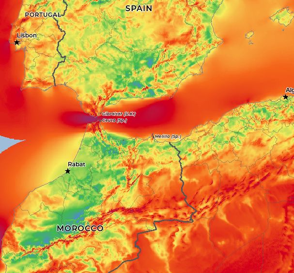
[Extensión geográfica] Global, la imagen inferior es una detalle sobre el estrecho de Gibraltar.