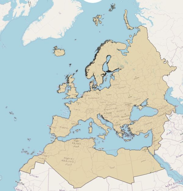
Costa de Europa
[Descripción] The EEA coastline dataset has been created for detailed analysis (e.g.:1/100000) for geographical Europe. The coastline is a hybrid product obtained from satellite imagery from two projects: EUHYDRO (Pan-European hydrographic and drainage database) and GSHHG (A Global Self-consistent, Hierarchical, High-resolution Geography Database).
[Autoría]
[Web original] European Environment Agency (europa.eu) https://www.eea.europa.eu/data-and-maps/data/eea-coastline-for-analysis-2
[Formato] Vectorial: shapefile.
[Resolución espacial / Escala] 1:100k
[SRS] EPSG:3035 (original); EPSG:4326 (local).
[Licencia] EEA standard re-use policy: unless otherwise indicated, re-use of content on the EEA website for commercial or non-commercial purposes is permitted free of charge, provided that the source is acknowledged (https://www.eea.europa.eu/legal/copyright). Copyright holder: European Environment Agency (EEA).
[Descarga en origen] https://www.eea.europa.eu/data-and-maps/data/eea-coastline-for-analysis-1/gis-data/europe-coastline-shapefile
[Descarga en local] v0802_costa
[Observaciones] Existe una versión de líneas y otra de polígonos.
[Extensión geográfica]